Austin’s transit agency, Capital Metro, is engaging in a long term transit planning process that could lead to future light rail lines, bus rapid transit, and enhancements to existing high capacity transit. Project Connect 2.0 follows on the failure of the 2014 bond referendum that could have built Austin’s first light rail line. Many felt that the effort last time suffered from too narrow a focus that some perceived as favoring a preconceived outcome.
This time, the agency is trying to take a comprehensive look across the region to conceive of an ideal regional transit network and prioritize how to get there most efficiently. Phase I of this process considered all existing plans for high capacity transit in the region and used a set of quantitative and qualitative metrics to narrow down the field to a reasonable set of corridors for more intensive study in Phase II.
At the Capital Metro June Board Meeting, the Board of Directors will choose which corridors move forward into Phase II. I have been involved heavily in this process as a member of the Multimodal Community Advisory Committee (MCAC) representing Vision Zero ATX. I am confident that the overall set of corridors moving into Phase II is a good set to allow a meaningful regional transit plan to emerge from this process – except for two corridors currently on the chopping block – Oltorf and Pleasant Valley – that I believe deserve to make it into Phase II regardless of the final scoring they received in Phase I.
These two lines score very well on the quantitative analysis conducted in Phase I as explained below, but scored poorly on the qualitative analysis. The qualitative analysis measured political and community support, ease of deploying projects, and a new concept called “regional connectivity.” I am not advocating actually changing the metrics or the Phase I report in any way. However, I believe the equity concerns – along with the ridership potential for Oltorf and Pleasant Valley – make a strong case to allow these two corridors to jump into Phase II for further consideration.
The ridership and equity metrics for Oltorf and Pleasant Valley show that these areas deserve consideration for high capacity transit
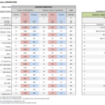
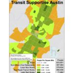
To follow along on this section, you can either click the underlined link in the next sentence to see the entire document or look at the images above for the specific pages. The quantitative analysis contains several key findings for both of these corridors, which indicate a strong case for studying them in Phase II. On page 35 of the Quantitative Evaluation Memorandum, you will see a chart of equity measures.
Oltorf and Pleasant Valley are the highest scoring corridors being considered in this process, meaning that they have the greatest potential for providing high capacity transit options to people of color, car-free households, and low-income people.
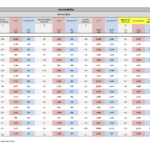
On the next page you will see that Oltorf and Pleasant Valley score the very highest on the existing population metric, meaning the most people would live within walking distance of stops, thoretically, on these lines compared to all others, including more people than the highest scoring overall proposed corridor: Guadalamar. However, on the employment metric, you’ll see that Oltorf and Pleasant Valley are relatively low, which is probably one of the biggest problems with considering a truly great transit investment here.
The metric “impact on existing riders” is probably the most important for pro-transit activists, fiscally conservative types, or environmentalists. Capital Metro was actually calling this “potential ridership” in previous versions of the report and decided to change it, but this is the best indicator of how well utilized transit investments will be between the different corridors under consideration. If you look on page 33, you will see that Oltorf and Pleasant Valley are the 3rd and 4th highest scoring lines after only Guadalamar and Highland, on this crucial metric.
Phase II will allow us to optimize these proposals – or not build them
Finally, a key is that Capital Metro decided at the beginning to only look at existing plans for corridors and to use existing end points of plans for the Phase I metrics. I think this was a good choice to have some reasonable cut off for this decision and to avoid perceptions of cheating. However, in Phase 2, we are not restricted by these old plans and visions. We will be looking at every single corridor that makes it into Phase 2 and trying to figure out what the optimal transit treatment for that corridor is. Then we can judge the best plans for each corridor against each other to come up with a way to prioritize a regional transit system..
So the point is that both Oltorf and Pleasant Valley – as drawn on the map in Phase I – have illogical end points, with each line basically ending at each other, even though both have large populations and regional centers nearby beyond that point. If they move forward into Phase II, we should consider at an Oltorf line that runs further east and a Pleasant Valley line that runs further south – and we should expect for them to basically show much higher ridership when the more logical end points are used.
Most importantly, Phase II is supposed to be a data driven planning process that will give us the ideal mix of investments to provide optimal transit on all of these corridors and to prioritize these investments based upon serving the most people, jobs, and students. Choosing to include Oltorf and Pleasant Valley in Phase II does not obligate anyone to any particular investments or any particular outcome. It just gives us a shot at a better understanding of how high capacity transit could prove to be dramatically beneficial for these neighborhoods and the region.
What about East 12th?
It is an important side note to the main point of this post that East 12th scores really high on the people of color equity metric, while not as high on the other equity metrics. Its overall equity score is lower than Oltorf and Pleasant Valley and its projected ridership is nowhere near as good. Another important consideration is that Martin Luther King Jr. Blvd is expected to make it into Phase II, so potential for investing in high capacity transit nearby – six blocks away – will be part of Phase II.
Perhaps reassurance by staff that a look at optimizing local bus on this corridor will occur in the Connections 2025 process could be sufficient to allay this concern, as the low ridership potential means we are very unlikely to conclude in Phase II that a high capacity investment makes sense on East 12th.



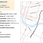
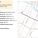

“So the point is that both Oltorf and Pleasant Valley – as drawn on the map in Phase I – have illogical end points, with each line basically ending at each other, even though both have large populations and regional centers nearby beyond that point. If they move forward into Phase II, we should consider at an Oltorf line that runs further east and a Pleasant Valley line that runs further south – and we should expect for them to basically show much higher ridership when the more logical end points are used.”
This would probably actually hurt their scores, as that ridership would be normalized by a longer length line.
That could be true if the other areas are lower density than the existing areas. But in terms of the metrics, there is a “Regional Connectivity” measure and both lines score 0 on it. If Oltorf were extended slightly East, it would reach a “Regional Center” from imagine Austin and would get points for that.
Also, in Phase II all of these existing metrics will go away, hopefully, and we will simply be talking about proposed ridership vs. costs.
Right, it might have better regional connectivity measure, but I was addressing the potential for a higher “ridership” measure. Which I don’t think is there.
Regarding the overall “illogical endpoint” issue. For Oltorf at least, ending at Pleasant Valley seems to be how it’s listed in Imagine Austin. I’m not sure why it wasn’t continued there either. Perhaps because it would still come up short of the bergstrom spur, which seems to be the preferred transit corridor(not 71) through that job center?
For Pleasant Valley, IA _does_ extend it further south. But that involves a connection through on roads that don’t actually exist yet. Not assuming/requiring their construction seems reasonable for this level or analysis.
Pingback:Today’s Headlines – Streetsblog Texas